


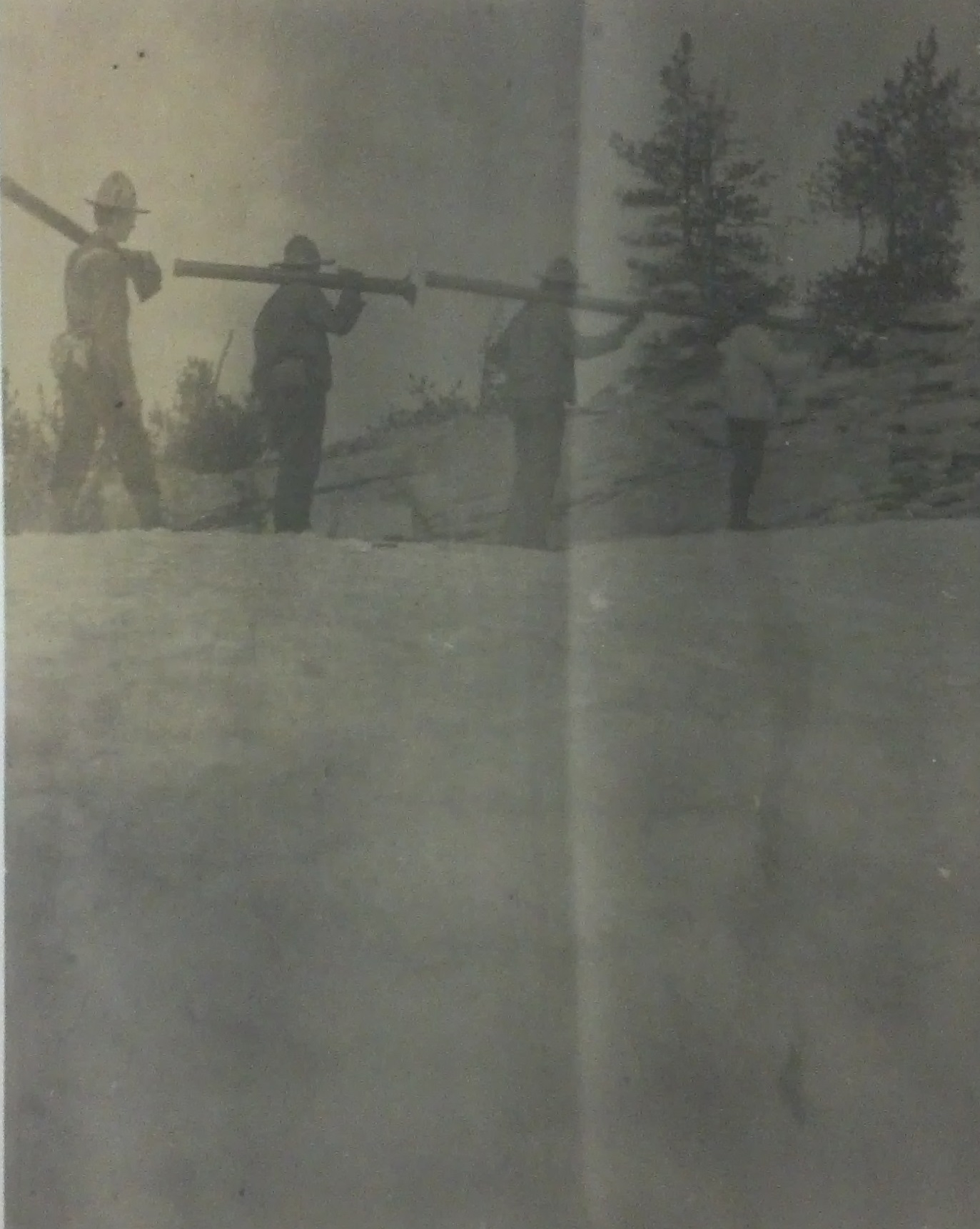
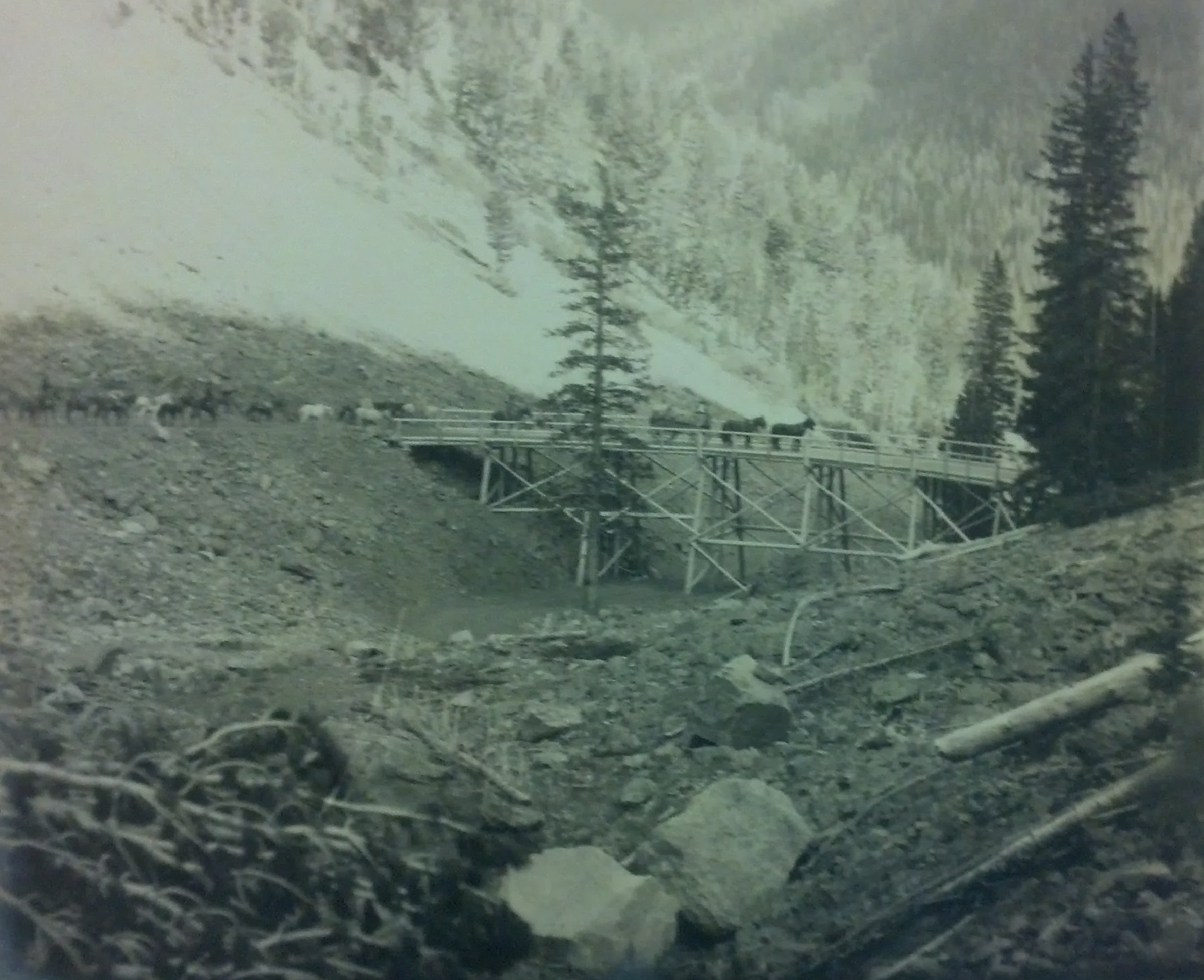

Howard Brady Carpenter, working as U.S. Deputy Surveyor, from 1904 through 1906 surveyed the watershed divide at the crest of the Bitterroot Mountains between the Montana-Idaho border in order to correct the boundary line created in 1864. Charting a route from north to south, Carpenter marked and noted each mile of the survey in remote and rugged wilderness. His survey notes provide details about the area’s landscape, geology and vegetation. Carpenter’s survey determined that the original boundary line set by the U.S. Congress (the crest of the continental divide) extended 3 miles further south than its previous determination. Depending on terrain and weather, Carpenter and his crew of 21 men completed 1.5 miles to 2 miles per day, working seven days a week. His crew and pack train of 44 horses blazed the trees along the survey line and built markers of brass caps on iron pipes or raised mounds of rock approximately every quarter mile.
At the 335th mile, Carpenter writes:
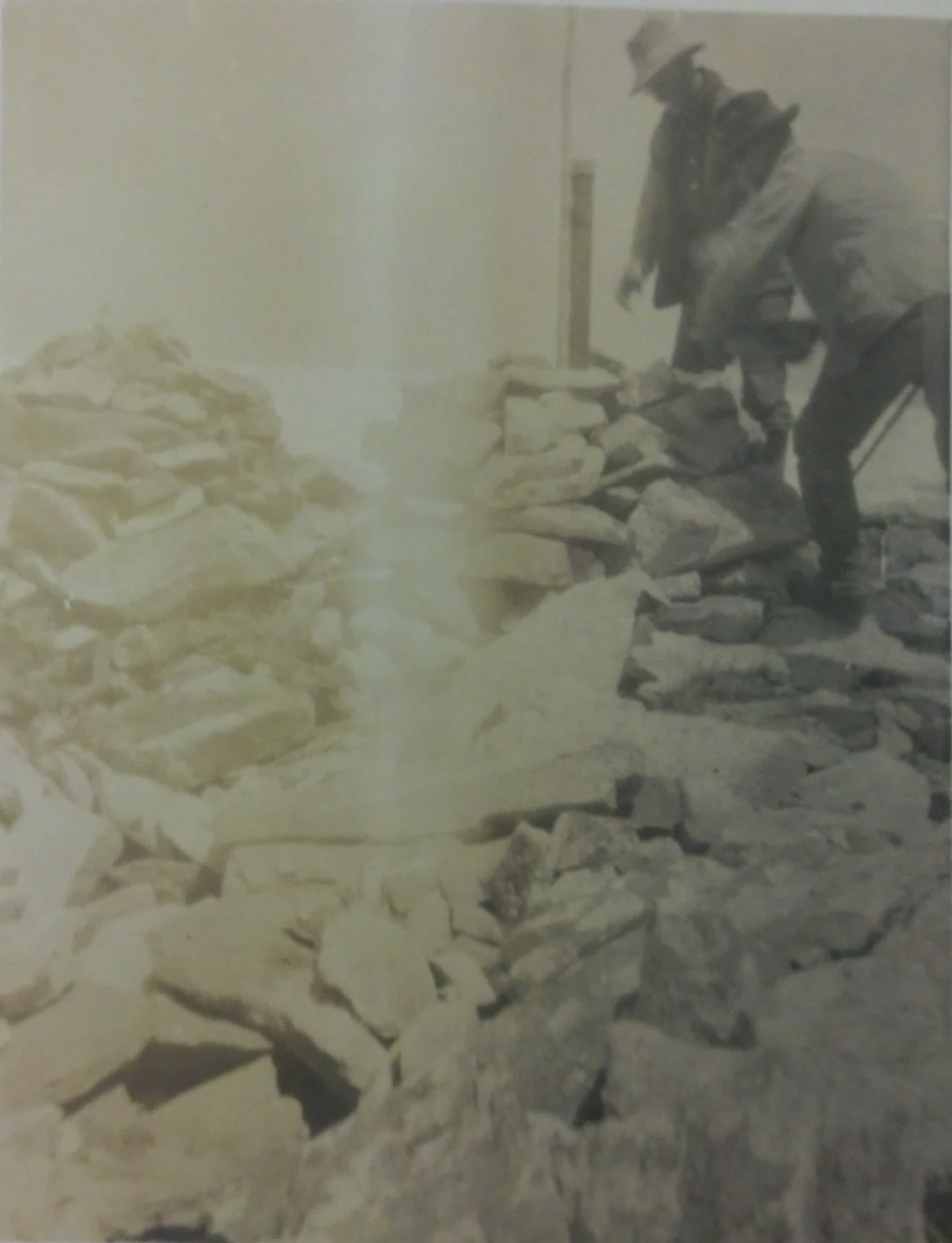
Set an iron pipe 3 ins. Dia 4 ft long, with flanges at the bottom, 8 ins. In the ground to bed rock for the 334th mile cor. A brass cap on top of the pipe has raised letters MONT. on N.E., IDA. on S.W. Raised + in center and stamped 334.028M on N.W. Pits impracticable. Raised a mound of stone 5 ft base 3 ft high around the post and raised a mound of stone 5 ft base 3 ft high W. of cor.
No trees within limit.
This cor. on high peak. Eleva. 8,800 ft A sharp rocky ridge puts off to west. Divide between two branches of Clearwater River.
Thence, descend-
This collection was donated to the University of Idaho Library by Frederick and Nellie Widel in 2000. The couple donated the three volumes of the papers in memory of John T. Carpenter, Mrs. Widel’s father. This collection is composed of three-volume set Field Notes of the Survey of the Boundary Line Between the States of Idaho and Montana, which describe the 739 miles of the project. According to Mrs. Widel, four copies of the notes are compiled: one each for the states of Montana and Idaho, one for the federal government and one set for the surveyor. The surveyor’s copy was the copy Mr. and Mrs. Widel donated to the library collections.
Information from MG 429 Howard B. Carpenter Papers Finding Aid: http://nwda.orbiscascade.org/ark:/80444/xv30468/