

Post written by Shelley Walker-Harmon, Gary E. and Carolyn J. Strong Special Collections Fellowship
This summer I had the opportunity to work at the University of Idaho Library’s Special Collections and Archives as a Strong Fellow, part of a yearly fellowship aimed at developing, preserving, and improving access to the library’s unique collections. Back in May, I was not quite certain what was in store, with one exception: I was sure that seeing the library basement filled with giant books and rare documents would be worth it. (I was right!)
A number of years ago, a large collection of aerial photos that belonged to the Potlatch Corporation were donated to Special Collections. Photos in this collection date from 1956 to 2005 and include nearly every year in between.1 My task, as a Strong Fellow, was simple: Take these thousands of jumbled photos, organize them, and make them findable, for anyone doing research on North Idaho forests and related topics.2
Over the course of two articles, I will relay a condensed history of the Potlatch Corporation, its impact on north Idaho (and beyond), aerial photographs, and a glamourous behind-the-scenes look at photo organizing. It was remarkably like a giant game of Rack-O-sorting, arranging, and finding patterns among hundreds of photographs until a bigger picture began to emerge.3
And that bigger picture begins with the company that created them.
The Potlatch Lumber Company
Just north of Moscow, home to the University of Idaho, is a small town named Potlatch. If you are familiar at all with the geography of Idaho, you will know that the town sits in the Panhandle, a narrow strip of forested land that separates Washington from Montana. In its heyday, Potlatch boasted the largest white pine sawmill in the world.4
During the early 1900’s the mill–and associated timber enterprise–was the beating heart of this company town, a settlement built entirely around the booming lumber industry.
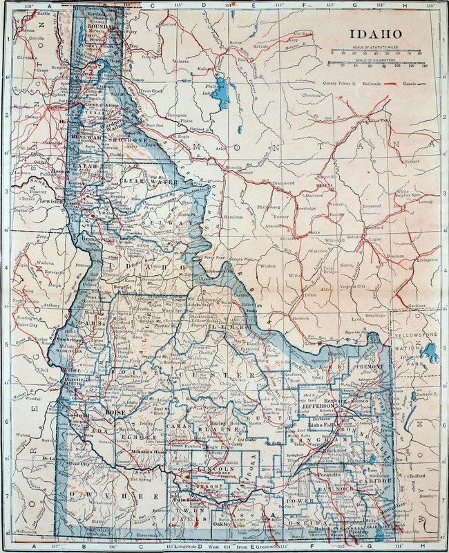
As a side note, I find it worth considering that despite leading the region in sawmill production, Potlatch does not appear on this 1921 map of Idaho.
The Potlatch Lumber Company was founded in 1903 by a group of investors that included Frederick Weyerhaeuser and several other major figures in the timber industry. (For those who grew up in the Pacific Northwest, the name Weyerhaeuser is probably a familiar one.) Weyerhaeuser established his own eponymous company three years prior, in 1900, beginning with just three employees in a small Tacoma, Washington office, and approximately 900,000 acres of timberland.5
Over the next century, the Weyerhaeuser Company grew into one of the world’s largest sustainable forest products companies.6 The Potlatch Lumber Company emerged after Weyerhaeuser and other investors acquired a large amount of white pine timberlands located in North Idaho. This new company expanded quickly, becoming one of the leading producers of white pine lumber in the Inland Northwest. The Potlatch Lumber Company later merged with Clearwater Timber Company and Rutledge Lumber company during the Great Depression. In 1931, these separate lumber and timber companies consolidated into Potlatch Forests, a company which championed the efficient use of forest resources.7
In the following decades, Potlatch Forests grew in a number of areas: land acquisitions, technology, product development, and investments. Following this growth the company became the Potlatch Corporation, and in 1973 it merged yet again with Deltic Timber to become PotlatchDeltic Corporation in 2018.8 This company is one of the nation’s most expansive timberland owners and producers of wood related products.9
While this drive-by history of the Potlatch Timber empire is full of dates and mergers and land acquisitions, what does it have to do with the Strong Fellowship, and the University of Idaho’s Special Collections? Why does this background matter? In order to get a sense of the expansiveness of the aerial photograph collection, it is important to get a sense of the reach this company has had over the region throughout the last century.
The timber industry is one of the most visible forms of resource extraction in Idaho and the surrounding Inland Northwest. Clearcuts and seedlings border state highways; checkerboards are apparent from the air flying in and out of Pullman, Spokane, and Boise. Walk into the local hardware store and you will likely see a Potlatch stamp on that 2X4 you need for this weekend’s DIY project. Despite its current existence as a small town in north Idaho, Potlatch represents something much bigger, just as each of these small 9X9 aerial photographs offers one tiny snapshot of a much larger view.
It is tempting to look at a single aerial photograph and pay little attention to it – especially if there are no landmarks, no rivers or lakes, no settlements, and no connection to life on the ground. But once you start adding them together, they form a supernatural view. This is a perspective that is completely impossible for us as humans to experience ourselves, without the aid of technology. With these aerial renderings of the Potlatch forestland, company executives and shareholders can view in minute detail their industrial reach.
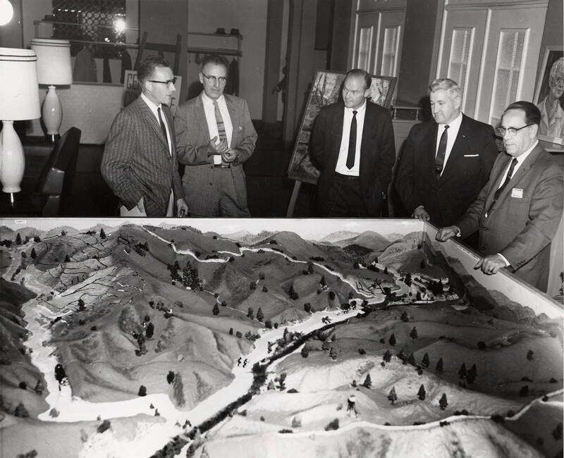
What was once traversed and documented on foot is now accessible to anyone on a sheet of photographic paper.
Looking Down from the Sky
Historically, forests were measured one stand at a time, with surveyors traversing undeveloped terrain to record what they could observe from the ground. The advent of aerial photography marked a technological shift in how forests were documented, moving the perspective from boots on the ground to cameras in the air.
Beginning in the 1920s early aerial photographs made a compelling case for vegetation mapping, but it was after World War II that things really began to change. Aircraft, cameras, photogrammetry, and affordable, high-quality equipment became more widely available. It was then that aerial photography became foundational to forest management. With a few images, forest management teams could view entire landscapes at once, mapping forest types, estimating timber resources, tracking fires, and monitoring change over time, more consistently and more efficiently than ground surveys alone.
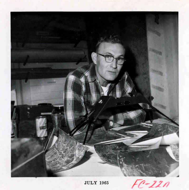
Paired with stereoscopic viewing and later enhanced by color and infrared photography, aerial images offered not just a broader view but a new way of seeing forests as interconnected and dynamic systems.10
Collections such as this one, comprised of historical aerial photographs preserved in archives provide a unique record of landscape change. They simultaneously document the evolution of forestry, illustrating the transition from field-based inventories to remote technologies used today. For companies like Potlatch, aerial photographs became essential business tools. They helped managers understand their timberlands, plan operations, monitor forest conditions, and make decisions within and across landscapes that stretched far beyond what any individual surveyor could see from the forest floor. These business tools have now become a historical record of Idaho’s changing landscapes.
Documenting Idaho’s Changing Landscape
Spread across nearly a dozen banker’s boxes, the Potlatch aerial photographs may appear at first glance to be simple images of forests, roads, rivers, and mountains. But together they tell a much larger story. Repeated photographs of the same landscapes reveal timber harvest, forest growth, road development, and changing patterns of land use across Northern Idaho.
Some years in the collection are represented by only a handful of photographs, while others contain hundreds. The reasons behind those differences are part of the archive itself. Were certain years connected to forest inventories, management projects, changing priorities, or other corporate needs? The photographs provide clues, but they also raise new questions–the kind that make historical collections valuable.
What began as a practical method of forestry management is now a resource for historians, foresters, geographers, and environmental researchers.11 These images provide a visual record of how Idaho’s forests have changed over time and an opportunity to study landscapes across multiple generations. The Potlatch aerial photography collection is more than a group of historical photographs. It documents scientific observation, business decision-making, and environmental change across much of the twentieth century.
While these photographs hold immense historical value, they are only useful if researchers can find what they are looking for. In my second post, I will take you behind the scenes in the archives and explore the gigantic geographic puzzle of organizing fifty years of aerial photography: one photograph, one flight line, and one forested landscape at a time.
Sources
-
Some years were not included in this collection as donated: 1958-68, 1970, 1973-76. There is no documentation of these missing years in the collection. ↩
-
In reality, the task sounded simpler than it was in practice. More on this in my next post! ↩
-
Rack-O is a game that was first released in the 1950s by Milton Bradley. The goal of the game is to organize your jumbled number cards into an orderly ascending sequence before the other players. ↩
-
University of Idaho Library Digital Collections, “A Brief History of Potlatch Lumber Company,” Potlatch Lumber Company Photograph Collection, accessed July 18, 2026 ↩
-
The story of Weyerhaeuser is its own separate entity, and there is much more to say than I can include here. For further reading you could start with Frederick Weyerhaeuser and the American West by Judith Koll Healey. ↩
-
“Company History,” Clearwater Paper Corporation, accessed July 20, 2026. ↩
-
PotlatchDeltic Corporation, “Potlatch and Deltic Timber Complete Merger,” GlobeNewswire, February 20, 2018. ↩
-
“Two of the Biggest U.S. Timberland Owners Near Deal to Combine,” Wall Street Journal, October 14, 2025. ↩
-
“Unasylva - Vol. 2, No. 4 - Forest Resources of the World - Aerial Photography.” ↩
-
Rachel Lilley, “LibGuides: Guide to Historical Maps in the Special Collections and Archives Research Center: Aerial Photographs”,” accessed July 10, 2026. ↩